
Our tour began in Chinchero, a small Inca town with ruins in the Andes. Much of the town retains the ancient streets, structures, and even cultures - of all the places we visited, Chinchero had the most original markets, farming, economics, and dress. The women, tall hats on their heads and babies in shawls on their backs, drove cows on the side of the road; families worked together making chicha (advertised by a stick projecting out of the doorway, red plastic bags tied to the end); I heard far more words in Quechua than in Spanish.
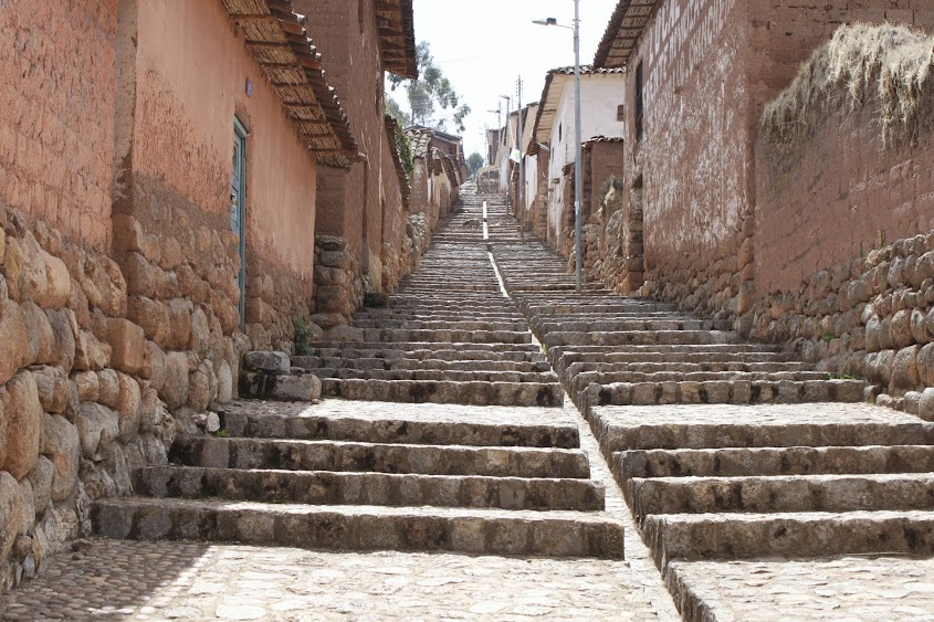
The ruins of Chinchero contain neatly-fitted stone in terraces and are situated in a lovely, if rather austere, landscape. At over 12500 feet, and dry, Chinchero isn't very lush and green (of course, it was still early Spring there!).
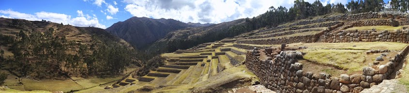


Chinchero is the only set of ruins I saw with multiple entire agricultural terraces made of fine cellular polygonal masonry (smaller multi-sided stones cut to fit exactly. The Inca also used coursed masonry [perfectly fitted rectangular stone] which could be encased - not aligned - or sedimentary - laid out in rows. Cyclopean polygonal masonry, like in Saqsaywaman, is made of huge stones).
 |
| See how the terrace stones fit each other perfectly? |
Next, our driver hurtled our little Mercades van around death-defying curves and ledges (and one rockslide) to take us to Moray, my favorite ruins of the Sacred Valley. Because OMG.
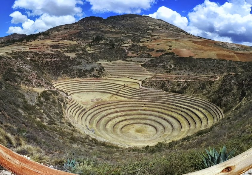
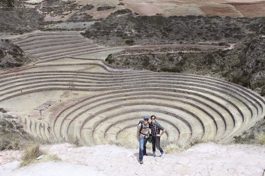
For scale, notice the people in these pictures:

And here we are, having walked the perimeter with slight shortness of breath! Moray is high!
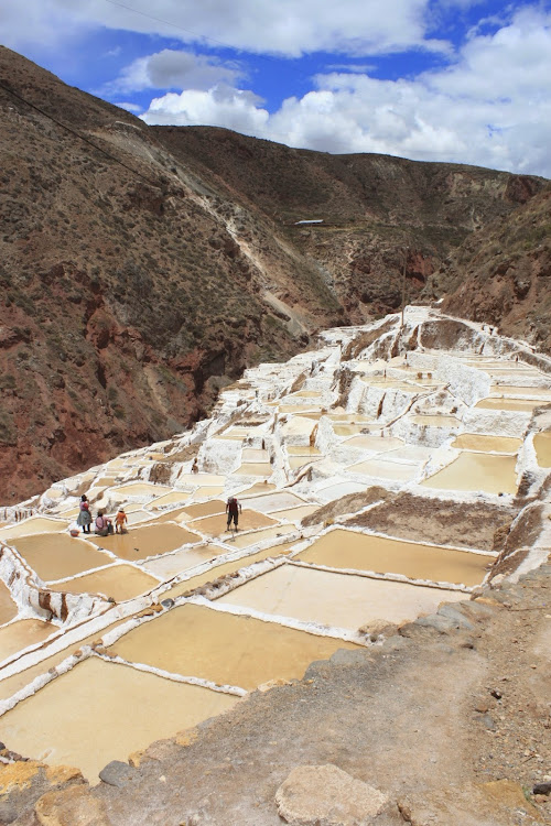
Next up were the salt pools of Maras. This just about blew my mind. The salt pools are ancient pools used to catch drainage off the mountains. Water trickles from the rocks into the pools; it's evaporated by the brilliant sun (very high elevation - between proximity to the sun, the clear air, and reflection off the white salts, we burned in under 5 minutes even with spf 85!). Salt remains, is collected, and sold.
But where does the saline content come from?
The water leaks out from subterranean streams that formed during collisions between plates during the seismic activity that formed the Andes mountains. The Pacific ocean plates and South America crashed together - land buckled - and mountains formed. Small fissures allowed siphoning of Pacific water, and ocean water comes out of the tops of the Andes mountains. Amazing.
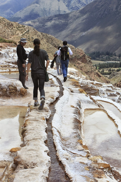 |
| Walking the edges of the salt pools (That's me trying to keep my balance; our guide is in blue jeans on the right). |
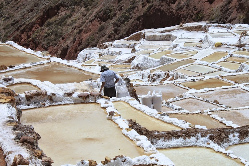 |
| A local worker collecting salt. Whoever wants to collect salt, can - they just have to join a co-op style community |
These collection pools pre-date the Inca empire.
After walking through the salt pools, we descended through the valley and town. It was a beautiful trek, but the homes and farms were very poor. Nevertheless, the kids and babies ran out to wave at us and shout, "Hola, Ingles!" Too adorable.
 |
| The valley below |
We met up with our van after the walk, and had to wake our driver, Sebastian, up. He spoke to our guide and they both laughed. Our guide explained that Sebastian hadn't expected us so soon; he'd told our guide, "German speed!" They do plenty of tours with German tourists, since our guide spoke German, and all the German tourists walk and climb quickly. Apparently David and I do, too - and for the rest of the trip, all pace was measured by "German Speed"!
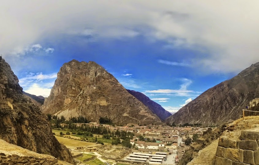
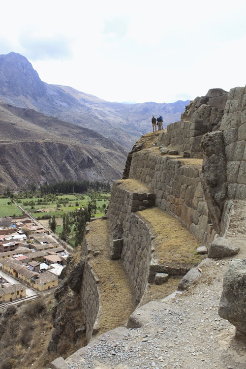
Our final stop was Ollantaytambo, a fascinating archeological site. It was apparently an Inca ceremonial center, and contains a few points of incredible interest:
- A large unfinished area that shows stones in the process of moving and carving. We still aren't sure how the Inca carved their stone.
- A pink granite quarry over 5k away and across the Urabamba river. Complex roads, ramps, and bridges allowed transport of gigantic stone blocks to the building site.
- Sunken terraces to allow farming of plants not suited for the cold and altitude of Ollantaytambo; the bottom area is 30 or 40 degrees F warmer than the top!
- Ventilated mountain storehouses for produce
- The face of pre-Inca god/messenger Wiracochan carved into the face of the hill opposite the temples. Interestingly, this figure is bearded, and the Andean people do not grow facial hair.
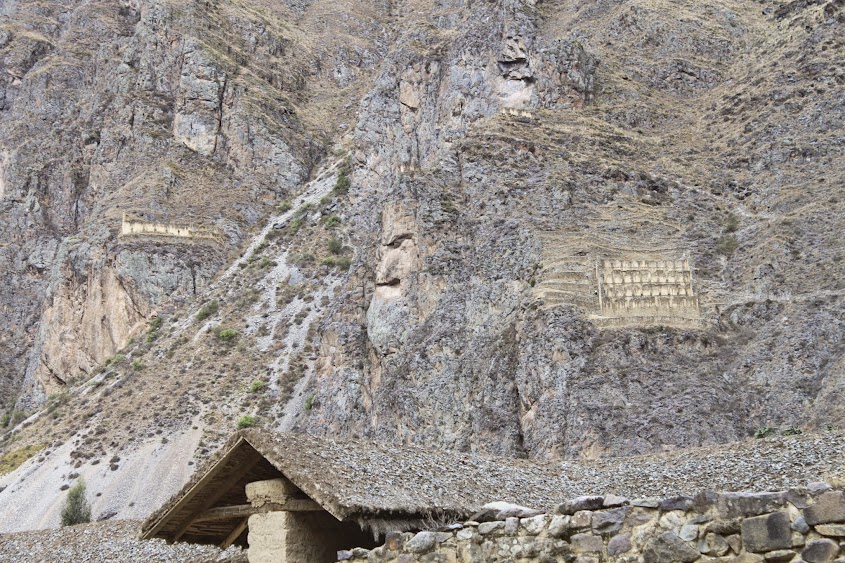 |
| See the face in the center? It is in profile. |
The Inca trail starts in Ollantaytambo, and so does the train: next, we board the train and head to Aguas Calientes for our two days at Machu Picchu.


The terracing is so impressive. Just to think that they did that all without the aid of backhoes and tractors. And to say nothing of the advanced agricultural skills. It's very impressive.
ReplyDeleteAll of that is incredible. The terrace microclimates, the salt infiltration... Plus the fact that your guide is a professional archaeologist and climber. Goodness. Does this trip get more amazing?
ReplyDelete